|
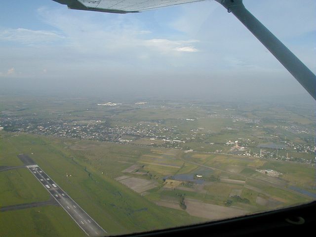
Mabalacat/Dau
Looks northeast across the eastern parts of Clark Air base.
The new runway built in the mid-1990s is visible, along with
the town of Mabalacat (left) and subdivision of Dau (right).
Want to correct or clarify information about this photo?
Send an E-mail to
clarkairbase@clarkab.org.
Mention you are referring to page "a52.htm".
|
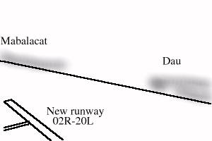
Orientation sketch
|