|
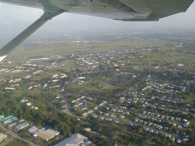
Lily Hill area
We are looking southeast, and Lily Hill is the wooded area at
the left side of the photo. The hill, barely a quarter of a mile
in diameter and not more than 105 ft high, served as a strategic defensive
spot for Japanese troops during WWII. The "barns" are in the foreground
at right. The large building at lower left (not cut off) is the
NCO Club (Top Hat Club).
Want to correct or clarify information about this photo?
Send an E-mail to
clarkairbase@clarkab.org.
Mention you are referring to page "a46.htm".
|
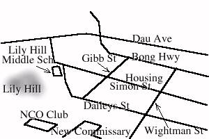
Orientation sketch
|