|
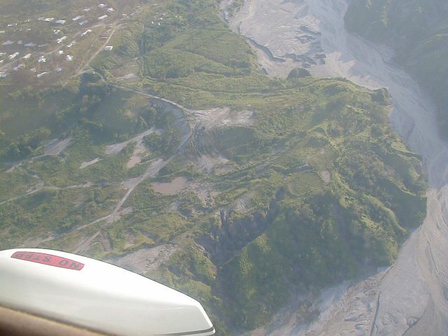
Mactan savanna
This view, looking west, shows the close distance from the Mactan
Housing Area (top left) to the pyroclastic mud-filled Sacobia River.
Mactan Drive is the loop-shaped road in Mactan, and the circles from
left to right are 81st, 82nd, and 83rd Place.
Want to correct or clarify information about this photo?
Send an E-mail to
clarkairbase@clarkab.org.
Mention you are referring to page "a36.htm".
|
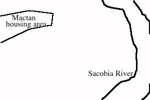
Orientation sketch
|